|
|
| Walk number 1 |
|
|
Silent Pool and St Martha’s Church (10.17 miles / 16.37 km / 5.00 hours):
|


 |
| Photos copyright © Graham Pearcey 2011 & 2019 |
|
Please click here for a map of the route.
|
- Use the public car park on Shere Road, Albury, Guildford, alongside Silent Pool, GU5 9BW. (Ignore the barrier in place to exclude larger vehicles. Private cars can simply pass to the right of it.)
- Leaving the car park by the footpath half way along, proceed through the woods to a cross-paths where Silent Pool is visible straight ahead but you turn left and ascend to the entrance gate for Albury Organic Vineyard. Here turn right to take the narrow path called “The Foxway”, which proceeds with the vineyard fence to its left and trees on its right until you start to climb an exceptionally steep hill.
- This path eventually reaches a crossing with a bridleway which is a section of the “North Downs Way” (NDW). Turn left onto the bridleway, and in less than five minutes there’s a fork left signed “Permissive Horse Ride” but you keep straight ahead (uphill) and carry on for another 20 minutes. On reaching the A25, turn right to reach the pedestrian entrance of The Plucky Pheasant café, from where you carefully cross the A25 to take a mud path between grasses to the Newlands Corner Discovery Centre. Walk to the farthest end of the car park, admiring the wonderful views of the Surrey hills on your left as you go, and continue along a stony path. After some time, two paths go off to your left, signed “Deer Trail” and “Dormouse Trail” respectively, but you continue on the current path as it becomes shadier under trees. Eventually, at a staggered junction with a damaged finger post (right), you take the obscure path on the left through trees, marked “Self-guided Trail”. After a short distance running parallel to your previous path, bear left, also marked “Self-guided Trail”, to emerge into a car park by a bench.
- Proceed straight ahead on a waymarked path into the trees. Initially keep left on the narrow higher (muddy) path, eventually following way markers first right and then left to descend to White Lane. Cross the road and climb steps (marked NDW) to a path that runs parallel to the road and once even touches it. Eventually emerge onto Guildford Lane next to Keepers Cottage. Take the rising path between the cottage and its garages, and climb to a cross-paths. Here turn right onto an unmarked, but broad, path. The main path is fairly obvious until after about ten minutes it swings left uphill to join a higher path.
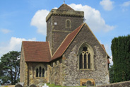
- Turn right. A stone in the middle of the path is inscribed “G.B.B. 1933.” Beyond the stone, turn sharply left onto a narrower steep path that leads to St Martha’s Church. Keep to the right around the outside of the graveyard wall until you come to three benches together.
- Just before the three benches, take the sandy path that descends to the tree-line. Cross a bridleway and continue very steeply downhill. Pass the sprawling Chilworth Manor buildings on your right as the path levels out. At a cross-paths, ignore the ‘permissive footpath’ ahead, instead turning left along the bridleway and then bearing right onto the parallel ‘permissive footpath’. When the bridleway and footpath merge onto a farm track, maintain direction until the track bears right.
- Take the next right to pass through a swing gate. Pass the ruins of mill buildings on your left, turn right at a T-junction, and proceed straight ahead alongside picnic tables to follow the wide track all the way to the green-painted iron gate at the end. Turn right along the road and cross the Tillingbourne river to meet Halfpenny Lane. Turn left at the Halfpenny Lane sign, proceed less than 10m and bear right onto a rocky footpath that climbs a hill. At the end is a road. Turn left and in less than 10m you come to a gate. Enter the field. Bear left and follow the clear track along the left-hand edge of the field. You have reached the half way point of the walk.
- In the ‘dip’ you reach a fenced-off stable and metal barn on your right, but maintain direction along the hedged track ignoring side turnings until the path ends abruptly at Manor Farm.
- Go right and immediate left, keeping the hedge to your left. At the second field maintain direction along the path, eventually catching a glimpse of Guildford Cathedral over to the right. On reaching a quiet, residential road, proceed through the gap and turn right. Almost immediately bear right onto a marked footpath that skirts Chantry Wood (right). Keep straight ahead at Chantry Lodge but, shortly after this, turn right onto the broad track just beyond Chantry Cottage, the former keeper’s cottage of the Austen Estate: the fingerpost indicates the NDW. When this track briefly descends to bear left into a farm, continue straight ahead on a narrower track (waymarked NDW). When the woodland ends, the sandy path passes between fields. When you reach a crossing of paths, continue straight ahead through woods. Another track merges from the left and you then ascend to meet a road.
- Turn left and in less than 30m turn right onto a narrow climbing path alongside Southernway Cottage. Keep ahead on this path as it becomes increasingly wide and sandy, and enters woodland. Follow the church sign uphill until you reach St Martha’s Church again. Maintain direction outside the graveyard wall so that the church is on your right, and then bear right to join a wide sandy track, with trees to its left and spectacular country views to its right. Descend steeply. After merging with a bridleway from the right, leave the NDW by bearing right at the next junction. Pass to the right of a ruined building before bearing left along a waymarked path (“Deer Trail”) which leads towards a small car park. Turn sharp right just before the car park, following another “Deer Trail” sign, to cross over Guildford Lane and join a marked bridleway. Follow the bridleway until it crosses the footpath that leads to Newbarn settlement (left), traverses a field and descends through a wood to reach Water Lane. Cross the lane, and follow a path with steep banks, past houses and left of a gate, which is padlocked to exclude vehicles not walkers.
- When the bridleway turns left by a cottage, keep straight ahead, passing to the right of another gate that may be padlocked. Arrive at a fork.
- Bear right and take the path through woods. On reaching the blue entrance gates of a sand pit, go straight ahead onto a narrow path. Cross a stile to proceed along the left-hand edge of a field. Continue through a new metal swing gate and an old wooden swing gate to reach the A248. Cross the road and turn left at the post-box to follow the pavement. On reaching the next junction, re-cross the A248 and proceed a short distance along the A25 to a field gate on your left. Now carefully cross both carriageways of the A25 to return to your car.
|
|
This route was last walked on 25 December 2023, and the directions were accurate then. Please e-mail me if you find any errors, if you would like a copy in Word format, or if you would prefer a version that starts and ends at Chilworth station (add 0.55 miles/ 0.25 hours).
|
|
Return to my Surrey walks page.
|
|


